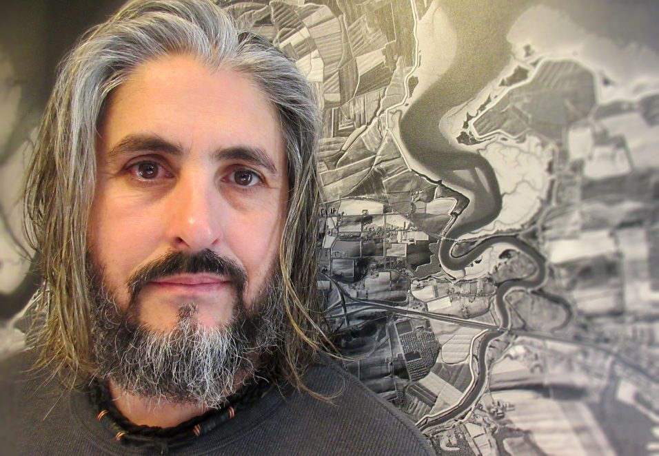
The Art Spot: Marcel Morin
Marcel Morin’s art is currently on display at the Wolfville Memorial Library at 21 Elm Avenue for month of February. Check valleylibrary.ca for open hours
Wolfville Memorial Library Exhibit: “The Lost Art of Cartographyâ€
WHO: I am a thirteenth-generation Acadian/Métis and have lived in Ontario, Quebec, Alberta, British Columbia, and all over Nova Scotia. I studied cartography at the College of Geographic Sciences here in the Annapolis Valley, graduating in 1992, and spent the next 15 years living and working in Vancouver. In 2007 I moved back to Nova Scotia with my wife Angela and my two daughters Bronwyn and Solange.
WHAT: My primary medium is digital design for print publication, however I have designed large architectural maps made of wood, granite, and ceramic. I was trained in traditional cartographic and graphic design techniques using large format horizontal cameras, dark room work, photographic techniques, mechanical separation and plate making, basically map making done by hand. Over the years I have translated these analog techniques to the world of geographic information systems (GIS) using spatial and 3D analysis, large geographic raster, and vector data sets as my creative tool kit while incorporating my own custom artwork into the design.
WHERE: I work from home in Grand Pré. My studio is in a 250-year-old Planter house built by Jeremiah Calkin in 1768, so I am surrounded by history. Internationally I have participated in large map-related architectural designs for SC Johnson’s Fortaleza Hall Racine, Wisconsin; Eaton Experience Center Cleveland, Ohio; and the Museum of the Bible in Washington DC. For the past 20 years I have been working with Pikangikum First Nation in northern Ontario and the Métis General Council of Alberta, specializing in Indigenous knowledge, ecological values and historical communities mapping. I published the Summit Series (specialized maps for the mountaineering community in BC), produced large floor maps for the Canadian Museum for Human Rights in Winnipeg and am currently working for Pimachiowin Aki, a First Nations-led UNESCO nomination in Manitoba/Ontario. Nova Scotia projects include large interpretative maps for the Landscape of Grand Pré, McMaster Mill Historic Park, McNabs Island Provincial Park, Beaubassin & Fort Lawrence National Historic Site, the large granite harvest table at the view park in Grand Pré, and the Wines of Nova Scotia and Explore the Annapolis Valley tourism maps.
WHEN: I have been drawing, painting, and designing as long as I can remember. In the late 1980s my art style was intricate black and white scribble and dot renderings which I called Lost Art. In 2007 I called my business Lost Art Cartography hoping to keep the art of traditional cartographic design alive in a world of big data and internet mapping.
WHY: Cartography is a blend of art and science. My maps are intricate paintings with complex colour palettes that reflect Canada’s diverse geography and history. In BC it was mountain cartography, working with First Nations and Métis is about conveying their intimate understanding of the land and animals, and in Nova Scotia it has been about history, especially here in the Annapolis Valley.